Planning your road trip in Google maps is simple and easy. You already have the app on your phone and you probably already know the basics.
While you are using Google Maps, select “search along route” from the menu and search rest area. The app will display a list of rest stops that are along the route you are driving.
You can also use the information in google maps to select the best rest stops to choose for your trip.
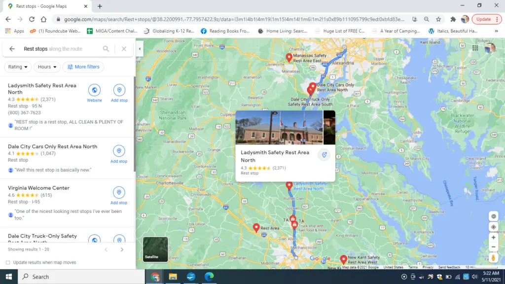
Finding Rest Stops On Desktop
If you are still in the planning stage Google maps is very helpful for finding rest stops along your planned route.
When you are looking at directions on Google Maps, a button that says rest stops appears in the top middle of the screen.

If you select rest stops, it will give you the option to add them to your route.

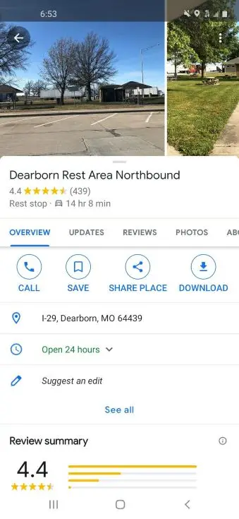
When you select a rest area you will have the option to view pictures, reviews, listed amenities, and any available contact information.
Read through a few reviews to determine if the rest stop is pet friendly or good for kids.
Some rest areas also have state specific art installations that make for great photos.
Finding Rest Stops On Mobile
Once you are rolling, you can search along route. This is the best way to find rest stops that are already on the way.
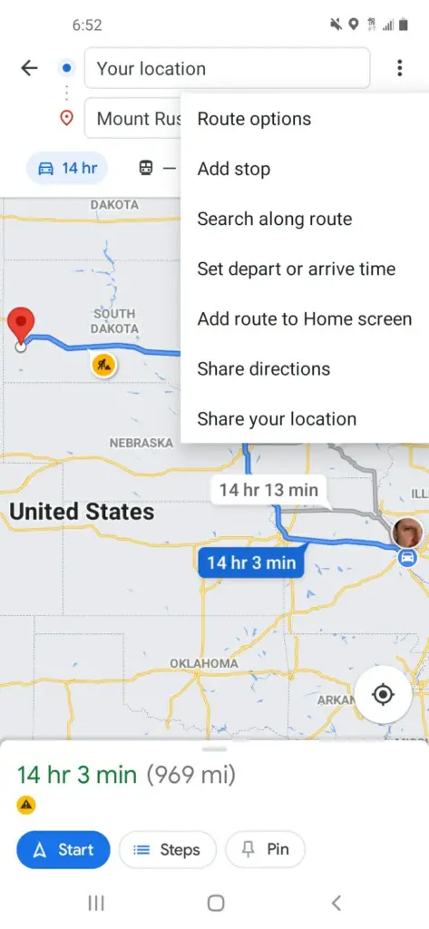
Google Maps will give you the option to add the stop to your route.
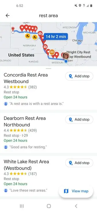
If you select the rest stop you will see user images, reviews, address, peak busy times, and questions and answers.
Finding Rest Stops Offline
Finding Rest Stop Reviews on Google Maps
When you are planning your road trip, the reviews on Google Maps can help you choose the best rest stops for your trip.
People share their experience at the site as well as interior photos, regulations and signage.
Find the reviews by clicking on the name of the rest area.
A screen will come up that looks like this
If you select reviews, you can see more. If there are lots of reviews for a particular rest area, you may be able to sort reviews based on topic like bathrooms, nap, dog, or vending.
Sharing Directions on Google Maps from Your Computer to Your Phone
If you have done your planning on desktop and you would like to share the route with your phone, simply select the icon that looks like a rectangle with an arrow.
Once you select this icon, you will have the option to send to any connected devices, your phone number, or your email address.
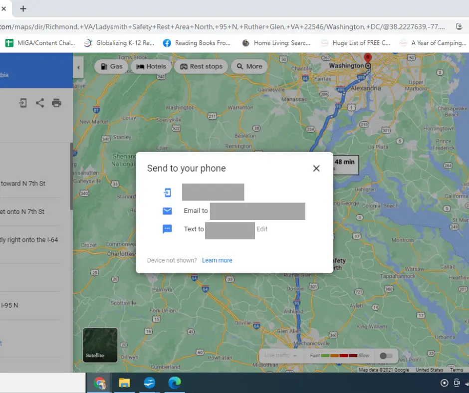
I recommend that you plan on your computer and share the route to your phone.
Google Maps desktop has many more features than mobile and is easier to navigate. You have more options for route planning and easier access to reviews and other information submitted by users.
Using Google Maps to Find Public Restrooms on a Road Trip
When you are on the road and you need to find a restroom, select search along route.
You have several options:
- Rest Area
- Truck Stop
- Gas Station
- Walmart
- Target
Any of these locations will have a free public bathroom.
If you are not familiar with truck stops these are some popular ones:
- Flying J
- Pilot
- BJs
- Loves
- Bucees
- Kwik Trip
- TA – Travel Centers of America
- AMPM
- Circle K
- Dash In
- Race Trac
Truck stops will have lots of bathrooms and often even showers for a price.
Truck stops are a bit more comfortable of a stop than a regular gas station, because they are designed to be stops for people who spend a lot of time on the road.
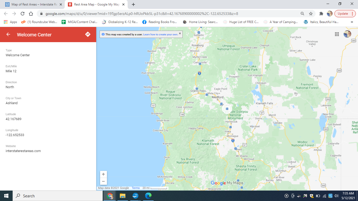
Other Rest Area Resources
There is a great resource for finding rest areas and overnight camping spots here. This map of rest areas was created by a Reddit user All50orbust.
The map is interactive and has layers so you can filter available rest areas that meet your needs.
Printing Directions On Google Maps
If you are going somewhere very rural, or you like to keep a travel binder. You may choose to print your directions including rest areas.
Once you have completed the route, click on the bar that shows destinations and estimated time. This will show you the details of the route.
A printer icon will be displayed at the top of the sidebar.
When you select it, you will have the option to print with or without the map.

This option is great for people who want to carry a paper copy of their directions. On mobile it is easy to print a copy of your route.
You may also choose to do this if you are staying over in a hotel and have access to a printer there.
The desktop version of Google Maps is much more robust and you may want to spend some time on the hotel computer planning your route.
Can you sleep at rest stops?
It is not recommended that you spend an entire night at a rest stop. Depending on the stop and your situation, it may not even be legal to take a quick nap.
If you plan to sleep at a rest stop, read the reviews that are available in google maps. Other travelers will share their experience at these stops.
Most importantly check the state laws regarding sleeping in rest areas.

Thank you
Google maps is a powerful tool and one you should use when planning your next road trip.
If you are traveling with a newborn or very young kids, planning your stops in advance can really reduce stress.
I have an ultimate road trip planning tool here. It includes information about how often you should stop with kids on a road trip. Stopping frequently will make the trip safer and more pleasant for everyone!
Enjoy your trip!