There are a lot of great features in Google Maps that you can use to plan your trip, and to make the navigation smoother.
There are a lot of great apps that I hear often in the road trip community, but I do 99% of my planning and navigation in Google Maps.
Google Maps can be used to read reviews of destinations, to avoid tolls, to keep your party connected, discover local attractions, view hours of operation, discover things the locals love, search an area through photos, and get traffic alerts. Google Maps is a great choice for navigation on a road trip, and to live like a local in a new city.
1. Reviews
The most valuable aspect of Google Maps is the HUGE library of user reviews.
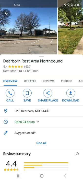
There are reviews for big attractions like the St. Louis Arch, and small, but important locations like highway rest stops.
Use the reviews to avoid finding yourself stopping at a notoriously dirty rest stop, or to find the locals favorite breakfast spot.
There is a trick to finding reviews by locals that I will share below.
2. Avoid Tolls
When you are driving in a new area, you may find that you are surprised to find a toll. Toll roads are treated very differently in each state, and you may not be prepared with the proper transponder, or other method of payment if you find a toll unexpectedly.
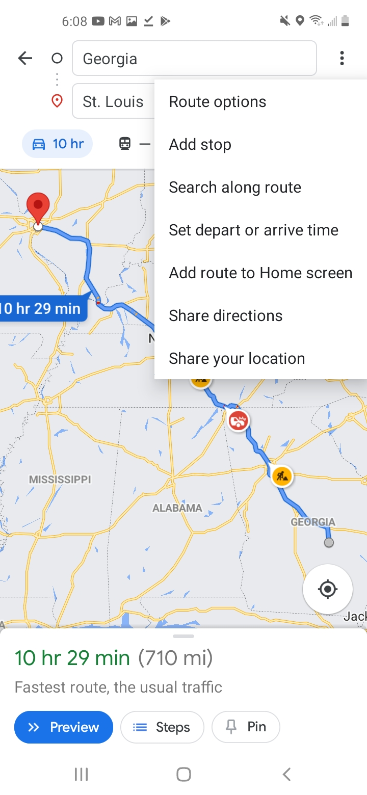
There is a feature in Google Maps that allows you to avoid tolls when navigating. You find it in the breadcrumb menu when you have selected a route. If you check the box to avoid tolls, you may find that it is on until you turn it off.


Turn on this feature when driving in cities, but perhaps turn it off when you are doing highway traffic.
You can be prepared for tolls in every state by checking this handy chart that describes what to do if you encounter a toll in any state or territory. Most states have an option to pay online immediately after you miss a toll without penalty.
I recommend you check your route in a dedicated toll app if you are traveling on the East Coast, where tolls are most common.
3. Layers
When exploring a new area, it is really helpful to have a bird’s eye view of the surrounding attractions.
Adding layers, such as satellite or street view can give you some great insight into your surrounding attractions.
This feature is super helpful for biking or public transit!

When we were in DC recently the kids loved riding the Metro system, but we were checking apps and maps constantly. Google Maps has a much more familiar interface, and because I use it so often it is a great choice for navigating public transit, or at least locating it!
4. Location Sharing
I use location sharing every day.
My husband is a truck driver and I never know when he will be home, but I can open my Google Maps and see where he is an how far away from home he is in real time.
This is so helpful on trips with other families or older kids. When you are making plans you can quickly see everyone who is sharing their location with you. It also shows how much charge they have on their phone battery!
You can find this feature by clicking on your profile in the top right and selecting location sharing. Then you will have the choice to share for a set amount of time or until you turn it off.
When you open Google Maps you will see an icon showing the location of each person who is sharing their location with you. If you click on the icon you can see how far away they are and what their battery life is doing!
5. Near Me
Another great Google Maps feature is the Near Me function.
You can search for gas stations, restaurants, hotels, libraries, museums, galleries, ANYTHING and add Near Me and it will give you a great list of options that are close to your current location.
Often these will show the price in an overlay over the pictures.
Pair this with all the available reviews, and this is a really powerful feature of Google Maps.

6. Hours of Operation
It is great to see what is open when you are searching and Google adds that information when you are looking at the search results.
This is another great way to avoid heartbreak on a road trip.
I recommend you use Google Maps to look for attractions near you so that you can get all the information you need on ONE screen. The distance, the reviews, and the hours of operation for your destination.
I love that they also include the option to visit the website or call the business. This is good practice when possible just to confirm that the information you are seeing is correct.
7. Local Guides
There is a feature inside of Google Maps called Local Guides.
You can find local guides by scrolling through reviews and clicking on any profile picture.
I like to browse a city by looking at the Latest Photos then finding the profiles with the words “local guide” under their names. You will be able to see all the reviews and photos this user has uploaded.
This is a cool way to discover places that are more off the beaten path and local favorites.
8. Photos
A big strength of Google Maps is all the user generated photos.
When you are searching a city, you can scroll down past the normal icons and you will find a section called Recent Photos.
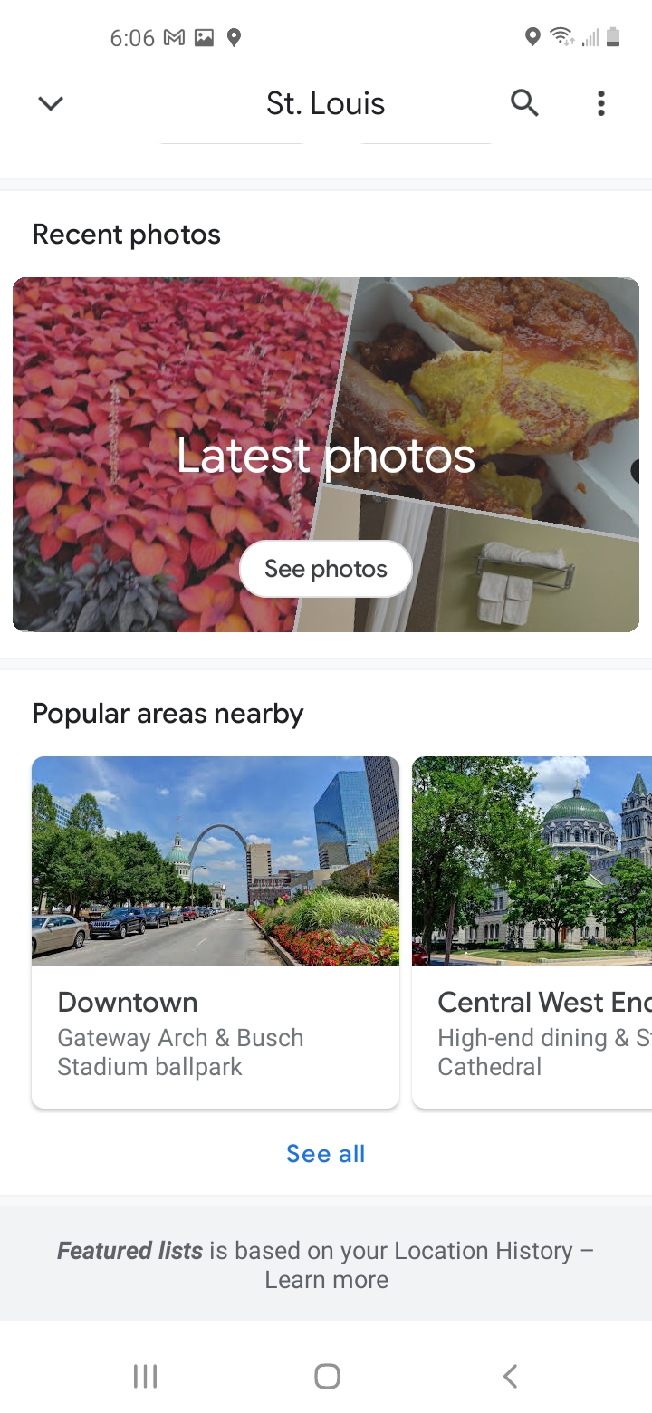
If you select this you will see an overlay of the city with the locations of the most recent photos.

Once you have selected a photo, maybe follow the local guide who uploaded it to find other great spots in the city.
9. Traffic Alerts
Google Maps can also save you time by offering alternative routes when there is a traffic incident ahead.
There are also suggested alternative routes as you navigate. This real time adjusting is a great feature.
They have limited functionality here, and I have plenty of friends who prefer Waze for navigation, but if you are already using Google Maps, this can be a big time saver.
There are a few other Apps that I see road trippers using very frequently and I wanted to give them a mention in this article as well.
Other Apps I Love
Google Maps is going to give you everything you need 90% of the time, but if you are budgeting for a very long road trip, traveling in a location where there are a lot of tolls, or roadschooling then you may want to add a few apps to your arsenal.
Waze
This is an app best known for reporting the location of speed traps, and it also contains user generated information.
They create a real family feel by allowing users to have custom avatars that show up on live maps. So you can see your Waze family every time you navigate with the app.
The real benefit of Waze is their superior traffic alerts. Because much of the information is user input the updates are faster and the app has a more complete picture of the traffic situation.
Waze is the app for you if you are DETERMINED to avoid as much traffic as possible.
TollGuru
I am a big fan of this app because it does one simple thing:
Tells you how much tolls cost before you get to the window.
Now, TollGuru has lots of other features, and those are worth checking out, but as the name suggests it was built for tolls.
TollGuru can even recommend alternative routes to save you money on tolls.
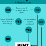
Smart Truck Route
This is a paid app for anyone who is driving an oversized vehicle. This app does not calculate any traffic or road conditions.
This is about clearance, it will keep you from destroying your RV on a low bridge. The app is very cautious and over two years of use my husband has never found himself trapped because of a clearance issue.
We bought the 3 year plan that was a bit over $100. My husband is a professional truck driver, so the cost was not prohibitive for us, but for one trip it might be overkill.
There are a few other apps designed for RV owners to keep them on safe routes for big vehicles, but this is the one my family uses.